The International Water Management Institute (IWMI), a non-profit global research organisation, has called for African nations to prioritise the inclusion of local communities in hydrological data collection to address critical gaps in water resource management. Amid escalating climate uncertainties and population growth, the institute emphasised that decentralised, community-led monitoring—bolstered by advanced technologies—could enhance the accuracy and responsiveness of water governance across the continent’s 63 transboundary river basins, which sustain over 500 million people.
Speaking during a policy briefing in Nairobi on Wednesday, IWMI representatives highlighted systemic challenges undermining Africa’s water security. Outdated or non-functional gauging stations, coupled with fragmented data-sharing frameworks, have left governments and communities ill-equipped to monitor river discharge rates, water quality, and consumption suitability. These deficiencies are exacerbated by the continent’s reliance on transboundary water systems, such as the Nile, Niger, and Zambezi rivers, which traverse multiple jurisdictions and require cooperative management to prevent conflicts and ensure equitable access.
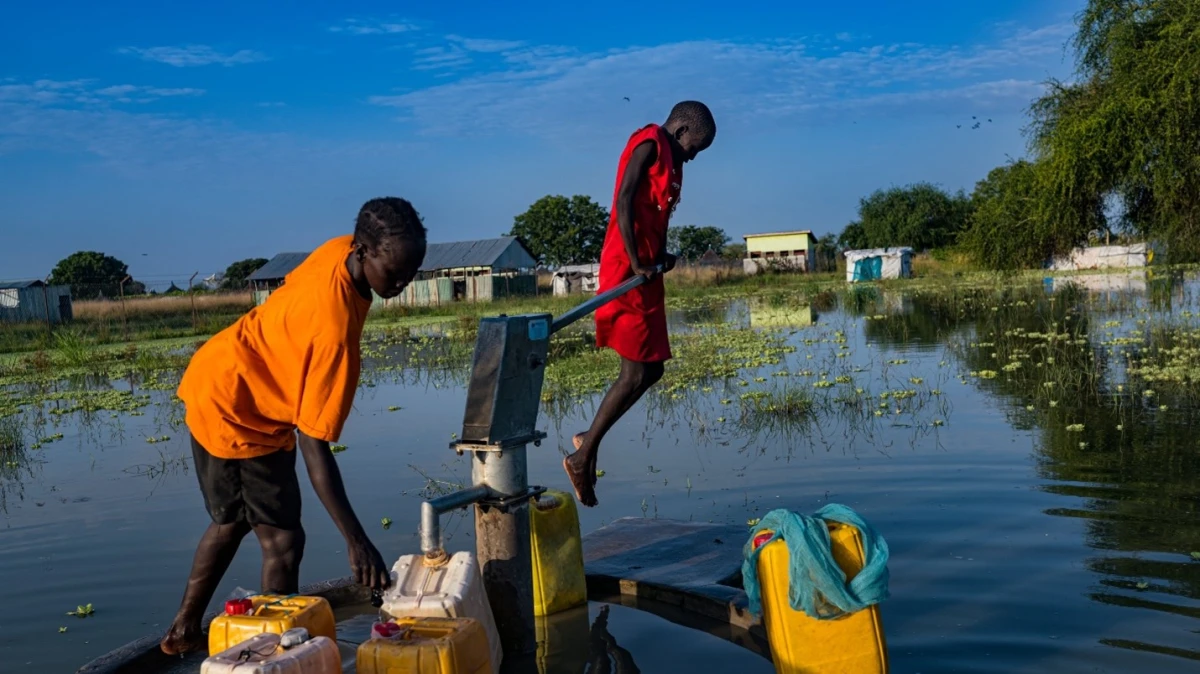
Central to the IWMI’s recommendations is the integration of local communities into hydrological monitoring processes. By training residents in data collection techniques—such as measuring water levels, sediment loads, and pollution indicators—and equipping them with mobile technology, real-time information can be relayed to national and regional authorities. This approach not only addresses infrastructural gaps but also fosters community ownership of water resources, enhancing compliance with sustainable usage practices. A 2024 IWMI pilot programme in Kenya’s Tana River Basin demonstrated a 40% improvement in data accuracy following the deployment of community-managed sensors and smartphone applications.


The institute further advocated for the adoption of remote sensing technologies, machine learning algorithms, and Geographic Information Systems (GIS) to complement ground-level data. Satellite imagery, for instance, can monitor river basin dynamics at scale, detecting seasonal variations, pollution hotspots, and illegal water extraction activities. Platforms such as the Digital Earth Africa open-data repository and the Africa GeoPortal have already enabled governments to analyse hydrological trends and allocate resources more effectively. When integrated with community-sourced data, these tools could provide a holistic view of water systems, enabling predictive modelling for drought and flood scenarios.
Transboundary cooperation emerged as another critical theme. With nearly two-thirds of Africa’s freshwater resources shared between nations, the IWMI urged governments to establish regional data hubs and ratify binding agreements on information exchange. The African Water Convention, ratified in 2023, provides a legal framework for such collaboration, yet implementation remains uneven. The institute cited the Volta River Basin Authority—a partnership between Ghana, Burkina Faso, and Benin—as a model for harmonising monitoring standards and resolving disputes through shared datasets.
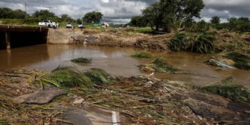
However, persistent challenges threaten progress. Only 35% of sub-Saharan Africa’s population currently enjoys access to safely managed drinking water, according to the World Health Organization (WHO), while aging infrastructure and underfunding impede technological upgrades. Political tensions, particularly in regions like the Nile Basin, further complicate data-sharing initiatives. The IWMI stressed that overcoming these barriers requires strategic investments in digital infrastructure, capacity-building programmes, and inclusive policy frameworks that prioritise marginalised groups, including women and rural populations.
In a forward-looking proposal, the agency outlined plans for continental “data cubes”—centralised repositories aggregating satellite imagery, community reports, and historical records—to enable real-time basin management. These hubs, supported by cloud computing and AI-driven analytics, could empower policymakers to detect anomalies, predict shortages, and coordinate cross-border responses. For example, early-warning systems linked to such platforms might have mitigated the catastrophic flooding in South Africa’s KwaZulu-Natal province in 2024, which displaced 40,000 people and caused $2 billion in damages.
As climate variability intensifies, the IWMI’s recommendations underscore a pressing reality: Africa’s water security hinges on bridging the gap between technological innovation and grassroots participation. By democratising data collection and fostering multilateral trust, the continent could transform its rivers from potential flashpoints into engines of sustainable development.